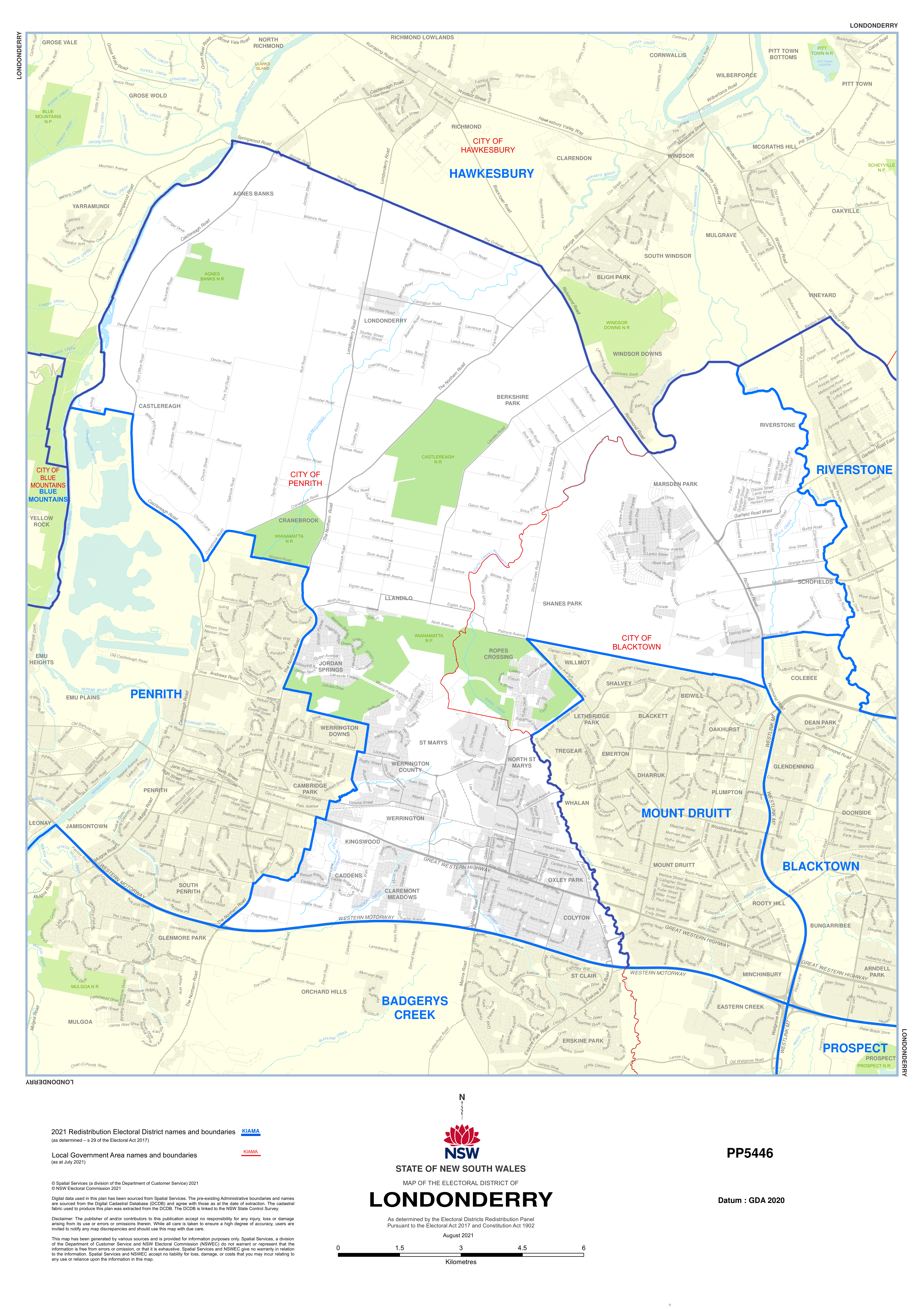
The Londonderry Electorate covers 192.7 square kilometres in Greater Western Sydney. It stretches from the suburbs of Agnes bank and Castlereagh in the North to Mardens Park in the East and down to Caddens and Colyton in the South.
Covering parts of the Penrith and Blacktown Local Government Areas and parts of the North-west Sydney growth corridor, Londonderry has a diverse population and is one of the fastest growing areas of New South Wales.
Suburbs
Agnes Banks (Parts), Angus, Berkshire Park, Caddens, Cambridge Park (Parts), Castlereagh, Claremont Meadows, Colyton, Cranebrook (Parts), Jordan Springs, Kingswood (Parts), Llandilo, Londonderry, Marsden Park, Melonba, North St Marys, Orchard Hills (Parts), Oxley Park, Riverstone (Parts), Ropes Crossing, Schofields (Parts), Shanes Park, St Marys, Werrington and Werrington County
Postcodes
2747, 2748, 2749, 2753, 2760, 2762, 2765
Local Government Areas
Penrith City Council and Blacktown City Council


